The idea behind this site is to share as much visual content as possible. I carry a GPS recording DSLR and an HD Camcorder. My first priority is photography, but I take out the camcorder when I can.
Trail notes are designed to help hikers and runners learn more about a specific hike taken. Here is what you'll find here:
Trails Taken - Route of the hike
Mileage- How far was the hike (I wear a GPS enabled watch, which records distance traveled, pace, elevation changes, etc. It works great when I remember to turn it on. Occasionally I lose the satellite signal, so please take these mileage numbers as an approximation, not necessarily an exact distance.)
Trailhead - Where did I start and finish, location of bathrooms, water, etc...
Notes and Impressions - I usually carry a small digital recorder to record voice notes, and enter the transcript here.
I'll include the images here as well. If I've taken video, you'll see it at the end of the notes.
Trails Taken - This short hike starts at the intersection of Rim Trail and Rheem Trail. Take the Rheem Trail down to the valley floor. When you meet the intersection of the trail with the path to the reservoir, the trail turns in to Canyon Trail. Go straight on Canyon Trail to the other lip of Rim Trail. Return the same way.
Mileage- 2.2 miles round trip.
Trailhead - End of Campolindo Drive, no water, no toilets, limited parking in residential area.
Notes and Impressions - Just once back and forth on this trail is good exercise, but doing it twice is even better. There are steep climbs, especially on the Rheem Trail side. The valley floor tends to get wet in the spring. The trail itself can get muddy, but there are also a few streams that cross the path, and you'll need to jump them or go through them. Halfway across the valley you can connect with the .4 mile trail to the paved reservoir path. If you come down on the Rheem Trail, run to the reservoir and back, take the Canyon Trail to the other lip, come back down and repeat, you'll have a 3 mile route with some nice hill climbs. There are some beautifully shaped trees along the way, and the valley is home to quite a few noisy birds, especially scrub jays.
Trailhead - Valle Vista Staging area, portable toilet, no water
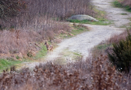
Notes and Impressions - This is a nice little loop for running or hiking with kids. I took my kids on this trail when they were younger. I often see little rabbits hop across the path as I walk or run. They quickly dive in to the thick brush to hide from the ever present hawks that circle overhead. Since this is next to the Upper San Leandro Reservoir, you'll have a chance to see and hear a nice variety of waterbirds. In the middle of this loop is a meadow that hosts trees, brush and is a sanctuary for all sorts of chirping and squaking creatures, and the creatures that prey on them. I took this picture on the Riche Loop back in November of 2007. He was just looking for dinner, and he left us quite alone.
Then, there is the mystery of the missing house. What you'll see from the trail are old, overgrown Indiana Jones kind of steps, leading to nothing. Who ever built these steps, and the house they led to, are long gone. All that's left is a conversation starter, especially with kids. Have fun on this trail.
Trails Taken - We started out on the trailhead at the end of Campolindo drive. We followed the trail north to the Reservoir. There are several side trails along the way, but we kept to the right. Eventually the trail drops down to the paved section of the Reservoir loop. Just before we dropped down, we came across a lost dog. After wandering around the dam area, we found the happy owners. After that, we forgot to access the Rim Trail on ramp at the other end of the parking lot, and walked right past it. So, we continued on to the Westview trail, and climbed back up on Rim. At the top, we took a left and followed the Rim Trail back to the start.
Mileage- 5.71 miles
Trailhead - 3849 Mt. Diablo Blvd. Lafayette, CA. This is the main parking area, with bathrooms and water.
Notes and Impressions -
The trail started out slightly wet in some places, and cracked in others. Much of the Rim Trail is exposed, so bring sun block and wear a hat.
Some trails offer switch backs to decrease the angle of ascent, but not the Rim Trail. Expect some heart pounding hills. You'll have great views of the Reservoir, see some canopies, and walk through some really pretty sections of the park area. At that point, there are bathrooms, water and picnic tables. It's a beautiful and popular area. Here is the EBMud Lafayette Reservoir page. Get there early for better parking.
This is a trail shared by runners, hikers and dogs, so step carefully.
There is a tremendous variety of wildlife in this area. I've seen deer, rabbits, numerous raptors and water birds. I almost always hear or see Wild Turkeys.
There are three trails that drop you to the reservoir from the Rim Trail. They are Big Oak Trail, Campolindo Trail, and Westview Trail. You can create numerous paved and dirt trail loops from the start at the parking lot, and each one would offer some nice hills to climb. Two other trails cross the valley from opposite sides of the Rim Trail. Canyon Trail is a gentler incline and takes you under a majestic old oak. Rheem Trail is steep and is challenging in both directions. This is 1.1 miles from side to side. About half way across is another trail that takes you to the reservoir.
Recorded notes:
.28 Little bit of a hill
.49 Totally exposed, brush on right, Oaks and Eucs on left, houses on right
.63 Serious horse deposit on trail
1.05 Beautiful view of reservoir, passing lots of people, runners/hikers/dog walkers
1.11 Lots of birds, especially Scrub Jays
1.2 On left is forest of Oaks and variety of trees in valley below, I can hear lots of birds down there
1.22 Seeing reservoir as you crest the hill
1.51 Really nice views of the reservoir from here, you can see people fishing and hanging out in play area, hills green
1.62 Heading down to reservoir
1.70 Passing beautiful twisted old Oak, nice valley, lots of bird activity
1.75 Jays really chattering today
(Paved section, dog rescue, lunch, siesta, etc)
3.23, Leaving paved reservoir, going to Westview Trail
3.32 Climbing up via Westview Trail, lots of twisted old Oaks here
3.51 Getting steep, no switchback, just up
3.90 Higher elevation, some pine trees and redwoods
R on Mott Peak Trail (Maud Whalen campsite is on your left)
R on Briones Crest (Look for Sindicich and Manicich Lagoons)
R on Old Briones Road Trail
L on Valley Trail
R on Yerba Buena Trail
R on Crescent Ridge Trail (Hike past Archery range)
R Seaborg Trail back to Trailhead (Keep to your left)
Mileage - 5.76 miles, Total Ascent 2431', total descent 2415'
Trailhead - Bear Creek staging area (EBRPD, not EBMUD) If you are coming from Orinda, the EBRPD Bear Creek staging area is on your right, just after the EBMUD Bear Creek staging area, on your left.
Notes and Impressions -
At the EBRPD Bear Creek trailhead, you'll find toilets and water and nice picnic areas. If the gate is attended, you'll have to pay a fee to enter.
.14 Starting on Old Briones road trail, sign on gate says watch for cattle and water line is broken...saw lots of horse poop
.31 Nice trail for dogs, passed a trail runner with dog, wide, beautiful tree lined trail
Steep hill on right, decline on left, trail is wide enough for car
.37 Valley on left is loud with birds
.44 Just passing beautiful old oak covered with moss, canyon on left and incline on right
.54 Little stream crossing road, you can see a lot of erosion on left from recent rain, where the side of the hill just caves in
.56 There is a nice bench to observe valley and hills across the way, Buckeyes getting leaves, nice Oaks
.64 Still on gravel trail, to left are hills with drop down to valley, hills full of birds, sun hitting that spot, some rock exposure in the hills across the way
.74 Trail is still wide fire road/gravel, to right is hillside, with terracettes, hawks hovering
.76 Crossing over a little stream
.79 So far it's been completely exposed, but nice views of valley to the left, Bay trees, Oak trees, to the right is grass
.90 Hear stream loudly on left
.94 At intersection of Mott peak and Abrigo Valley trail, big meadow and pit toilet, giant old oak here, must be hundreds of years old
.94 Starting on Mott Peak, to left is big lean-to structure
1.03 Crossing a little stream on the trail...starting to climb
1.11 Climbing up Mott Peak, water tower on right, huff huff...
1.14 Bear to left on Mott Peak trail
1.14 Trail is pretty wet and muddy in middle but dry on left, mostly exposed with brush and oak, occasional bird activity
1.22, Trail is really muddy here, stream almost going down the middle of it
1.25 It's like I'm walking through that clay we used to use in 3rd grade
1.28 Climbing on Mott Peak Trail, totally exposed rolling hills as I go through the muck...some sign of spring wild flowers, hawks circling above
1.34 Path that goes to right, but I'm staying to the left, trail marker ahead, hawk on the trail marker, but he disappears as I approach
1.40 At intersection of Mott peak trail and Black oak trail, I'm staying on Mott Peak to left
1.44 Lots of paw prints on the ground, probably dog, seeing lagoons down below
1.46 Going up hill, in area of rolling hills and seeing lagoon
1.55 Cattle country, on ridge, see rolling hills all around me, to my left in distance is San Pablo Bay
1.57 Far off I can hear a train (to left) seeing birds hunting
1.68 Numerous little trickles of water going across the trail, ATV tracks on road
1.73 Just went through gate, giant hawk on fence up ahead, beautiful views of mothball fleet in Suisun Bay, Benicia Bridge, see Martinez, Concord
1.77 At intersection of Briones Crest Trail and Mott Peak Trail, all is lush and wet, (Also called Ivan Dickson Memorial Loop Trail
Hiking down Briones Crest Trail, extremely muddy in spots
1.84 See some ground squirrels on left, some lagoons with lots of birds, ducks, etc
1.88 Little bench to eat lunch or take a break
Sitting on bench eating lunch, seeing refineries, mothball fleet, windmills off in distance, Mt. Diablo
Cow crew ahead checking me out
2.12 Sign explaining terracettes and seasonal ponds
2.18 Trail runner just passed me, now a biker, lots of trail activity, see some terracettes on hills
2.2 Full sun now, seeing more hikers, runners, bikers
2.39 At intersection of Briones Crest Trail and Old Briones Road, taking a right on Briones Crest Trail
2.51 Taking Old Briones Road to Valley Trail
2.53 Seeing lots of ground squirrels
2.56 Taking Valley Trail because sky is washed out today and I want some canopy shots
2.60 Trail is very wet, rutted, bikes, ATVs, cattle, people, horses, just a mess
2.71 Steep cliff on left and drop on right as I descend Old Briones Road
2.74 Heading down in to valley, beautiful trees coming up
2.81 Trail is crazy wet, just passed hiker and her dog, lots of dogs on trail today
2.87 As you come down there are nice rolling green hills on right, Buckeyes starting to bloom
2.90 Seeing fresh bike trails, I don't know how they got through this mud
2.95 Little stream flowing right on left edge of Old Briones road, but then goes under via pipe and blasts out on right
3.04 Cattle pen ahead, going to Valley Trail
3.18 Valley trail goes to left, taking that
3.33 Passing a bench on Valley Trail, on left are hills with terracettes, hawks circling, maybe a cave on the hillside? I'm on a rancher road, barb wire fence on right, maybe a stream bed on right (can't see), lots of birds about
3.50 Getting buzzed by giant bees, but they're not bothering me, just checking me out
3.56 Little lagoon, Great Blue Heron just took off
3.67, Taking right on Yerba Buena Trail to right, path is not too apparent, but you'll see the gate across the meadow
To get to Yerba Buena trail you need to cross the meadow and go through gate
Starting Yerba Buena trail, it's wet and there are bike tracks in the fresh mud, smelling a musty, forest scent
Early part of Yerba Buena, lot of Bay trees, very wet
3.96 On Yerba Buena to left is an steep incline, to right are nice Oaks and Bay trees and hillside
4.04 On left of Yerba Buena trail hillside is steep, and trees are showing their roots after erosion washed away soil
4.05 Remains of old gate on trail, part of fence post is embedded in tree
This part of Yerba Buena trail at mile 4.13, quite a few Bay trees, shrubs, Oaks, ferns, quite a variety of life, hawks flying over me
4.2 Yerba Buena trail starts going up hill
4.35 on Cresent Ridge, looking at valley below which is lush
4.4 beautiful oak groves on right, gnarled and twisted, really pretty
4.43 Heading down Crescent Ridge trail, little bit of downhill, heading to valley below, can see the archery range
Hearing frogs on right in the Oak forest
Somewhat steep descent coming down
4.79 Just passing Archery range, friendly cows hanging out
4.94 Taking right on Seaborg trail
4.95 On Seaborg trail, wide trail, dirt and gravel, on left is dense brush, on right is open meadow, hearing stream on left, seeing Manzanita bushes
5.16 Stream is down below, seeing small waterfall
Very steep side trail to waterfall, steep and slick
5.23 Walking this part of trail just a constant sound of stream on left
Mt. Diablo doesn't get snow every year, and it looks like this year we'll see it covered in snow from multiple storms. After last weeks hike to see the falls in Mt. Diablo State Park, we decided to visit again, and entered the park via the Mitchell Canyon staging area.
Trails Taken - From the trailhead, we took Oak Road to Mitchell Rock Trail. Then, we went right on Mitchell Rock trail and climbed to Twin Peaks, at 1733 feet. We descended a little and came to the Eagle Peak Trail split. We took the trail to the left, which descended down to Coulter Pine Trail. At this point, you could take the Coulter Pine Trail back to Oak Road and the Trailhead, but we continued on to Bruce Lee Road. We took a left on Murchio Road, and another left on Watertower Road. That connected us to Oak Road, which we took to the Trailhead.
Mileage - 4.1 miles, total ascent 1757'
Trailhead - South end of Mitchell Canyon Road in Clayton, California. Bathrooms and Interpretive Center located here as well. Entrance fee required.
Notes and Impressions - At the time of this hike, the trails were quite wet and muddy. In addtion, there is equestrian traffic on some of the main trails, so be careful for horse bombs.
I noticed quite a lot of bird activity on this hike, especially Jays. They seemed to be the lookouts on the trail, letting the other creatures know we were on our way. We saw some skittish rabbits and a load of raptors.
Often, the trails narrowed with heavy brush on both sides, and in some cases, overhead. Trail conditions ranged from rocky, to muddy, to steep.
As we climbed, the trails became narrow. You won't need ropes to pull yourself up, but you will feel it in your cheeks and legs.
That giant scar across the face of Zion Peak is explained on the MDIA website:
The diabase quarries on the northside of the mountain (Zion Peak) are currently being excavated for crushed rock and rip rap material.There were several excavations in graywacke on the northside of the mountain for the same purposes,but they are now abandoned. Blue schist from the Franciscan rocks on Mt. Diablo yielded good dimension stone and was popular for building construction due to its color.
Overall, a pleasant and moderatly difficult hike that offers great views and exercise.


 East Bay Trails